
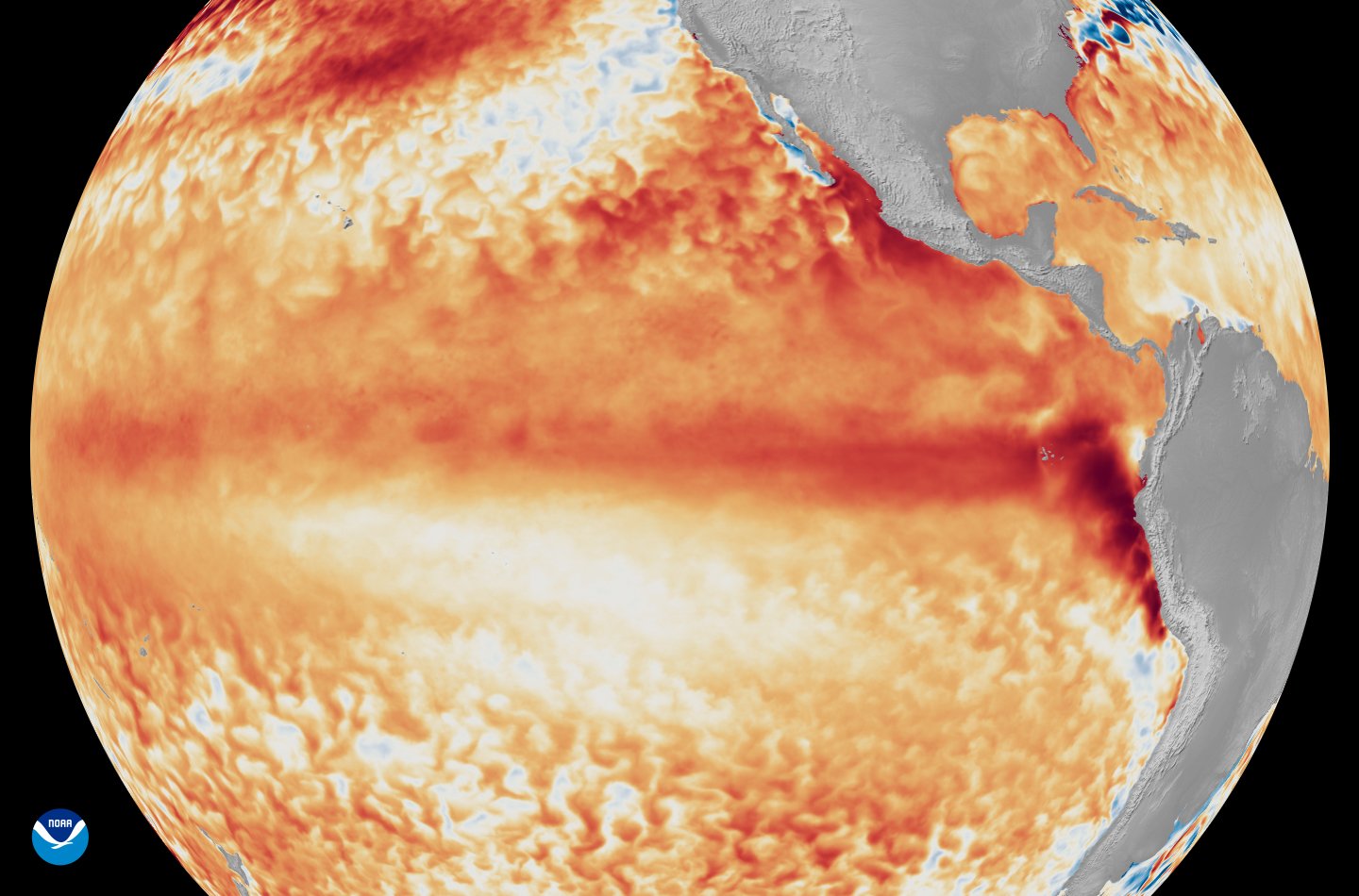
Pacific sea surface temperatures have reached 0.5°C above average, marking the start of El Niño, the US National Weather Service announced today. The agency also updated its strength outlook, now forecasting a 63% chance of a “very strong” event—a surge of 2°C or more above average—which would rank among the most intense in recorded history.
The name El Niño dates back to a 17th-century legend among Peruvian fishers. Translating to “the child,” the name alludes to the Christ Child as the warm waters often surface around Christmas. While the cyclical weather event is not caused by human-induced climate change, its effects are amplified by it. By mid-May, sea levels around Peru were already about 16 cm above the long-term average.
The weather pattern also causes temperatures to rise as excess heat transfers from oceans into the atmosphere. The consequences are global: extreme heat waves, droughts, and floods pose risks for water supply and agriculture. The phenomenon is estimated to peak in early winter.